
Finally, after almost two month without a night outside, the schedule and life at home allowed me to get out again. I had been watching hiking movies on YouTube, read blogs and scrolled through Instagram photos a lot during these months. My feet were itching to get out again, and my mind craved solitude and the peace you only get in nature.
As said in my Pre-hike post, I planned to hike with my buddy. Things came up for him, and I ended up hiking solo after all. I didn’t mind though, since I like my solitude. I’ve been stressed out lately, and I really looked forward to disconnect from everything and just relax in nature without cellphone reception 🙂
It was roughly a 5h drive to Tresticklan and I left home a bit after 08.00. The car GPS showed me all sorts of different routes, one longer than the other, but I had a pretty good notion on how to drive since I was there with my daughter last October.

I arrived there a little after 13.00 and set of. 6-7 cars where already parked there. There is a trail that goes straight through the park to the cabin Budalsvika on the Norwegian side of the border. In the middle of the park there is a 5km loop trail that goes around the park and back to the trail to Budalsvika.

I had lunch at a rock overlooking the lake Stora Tresticklan and then started walking the loop trail. A couple with a dog day hiked a bit ahead of me. We passed each over a couple of times. When I reached the southern end of the loop trail I continued along a trail that wasn’t marked on the map. I went on until I reached a march with no foot-bridge across and then turned back. I didn’t see the couple again.

When the trail started to go back north again I followed another trail about 1km south. That trail goes all the way to the southern border of the park, and was the one I planned on hiking north-bound if I had hiked with my friend. I turned back, finished the loop trail and headed towards Budalsvika and the Norwegian border.

I didn’t have anywhere special to go, or any time limits, except that I should be back home sometime on Sunday. When I reached the Norwegian border I started looking for a spot to set up my tent. It was late in the afternoon, too early to set up camp, but still late enough to start looking.

The ground in Tresticklan and Lundsneset consists of rift valleys and the soil is very shallow on many places. On most places with deeper soil the ground is covered with blueberry bushes or calluna witch makes it hard to find camp spots. The rift valleys also makes hiking in east-west direction harder than north-south since it’s a lot of ups and downs. The park consists mainly of pine trees. The trees are old, and there are a lot of dead standing trees all over the place. The dead trees, and the shallow soil makes a lot of trees falling, and you see both live and dead trees fallen over the trail. Something worth taking into notion when choosing a spot to set up your tent.
I found a good spot on the Norwegian side of Boksjön, a litte bit south of Budalsvika. But I still thought it was too early to set up camp and started hiking a trail going south. I had the first camp spot in mind if I wouldn’t find a better one. After a while, up on a ridge, I found a good spot to set up camp. The soil was pretty shallow, but there were some rocks to anchor the pegs that didn’t get stuck in the dirt.
I made dinner and laid in the tent and listened to the birdsong. The weather had been shifting between sunny and cloudy, but had mostly been good. I guess the temperature were around 15C. Kind of the perfect temperature for hiking.
I read “A walk in the woods” on my ebook reader for a couple of hours before going to sleep. This was my first night using a Quilt and I had been looking forward to trying it out. I’m not completely sold yet, but it was nice. I did have trouble getting it to stay in position when I tossed and turned though. I really want to try it again when the temperatures are close to freezing to see how it does in those temps.

I slept really well. I was happy to be out there, and I felt peaceful. I woke up to a choir of all sorts of birds. The weather was a bit better than the previous day. It was still cloudy at times, but the sun was out more that yesterday.

I kept walking on the ridge and found a spot with a great view over Boksjön. I hadn’t walked far from my camp site but I stayed there for over 20 min just looking at the scenery and listening to the birds singing.
I kept walking the trail. It was steep decline down to the lake. The trail continued straight through a marsh and into a forest. Halfway in the marsh I lost the trail. I had to check my map several times and bushwhacked through the forest until the trail was visible again. Apparently I was on the trail all along, but it was poorly marked and I don’t think these parts were used a lot since it was grown over. The maps for Lundsneset were pretty good though. The marked trails had km-marks on them so I had a good notion on how far and how fast I was walking.

I found a great spot at Boksjön to filter my water. I used a sports water-cap to back flush the filter witch worked out great. The cap is a lot smaller and weighs less than the included syringe, and it works just as well. The water was incredibly clear and with no evident taste at all Every time I filtered lake water before it’s always been at least a little taste and color of humus. But the water here was as clear and tasteless as tap water.
I hiked the trail until I came to a road, and then turned back again. I went back to the lake and had my lunch there. After lunch I hiked back towards Budalsvika. I had hiked parts of a loop trail, and took the other way back to Budalsvika.

I went back to Sweden. It was a bit early to set up camp, so I started hiking the loop trail on the Swedish side again, in the opposite direction. I found a great spot about 30 meter of the trail. It was shallow ground on some places, but fortunately there were rocks scattered to anchor the tent. I guess other hikers had used them for the same purpose.

It was a truly wonderful evening. The weather was perfect, and it was warm outside. I sat on a rock reading for a couple of hours before turning in. The night wasn’t wonderful though. It started raining a lot during the night, and the sound woke me up several times. Condensation (I hope) dropped down in my face. I saw a slug climbing the outside of my tent. Two more were on my shoes and then two more inside my pack. I flicked them away and got up.
I had a breakfast of tortilla with sausage and tortilla with Nutella. I didn’t bother with coffee since it was raining pretty heavily, and I didn’t want to use the stove inside the tent. I packed up and left the campsite.
I had managed to keep my feet dry for the most part of the trip, but this morning during the walk back to the car they got wet instantly. The rain stopped, but the trail was really wet. It was less than an hour walk back to the car. I packed up and left Tresticklan. On my way home I stopped by Burger King and filled my body with delicious fat-food. A tradition I have to keep after every hike 🙂

I’m really glad that I got away on this trip. I’ve had a lot on my mind lately, and really needed the solitude and to disconnect from work and everything that occupied my mind. I felt really peaceful and relaxed while out hiking and it was a trip that gave me new energy. The scenery is beautiful, and I don’t think I’ll do any more hikes through spouse-plantations just because they are conveniently close to home. It’s well worth the drive to get to more interesting places.
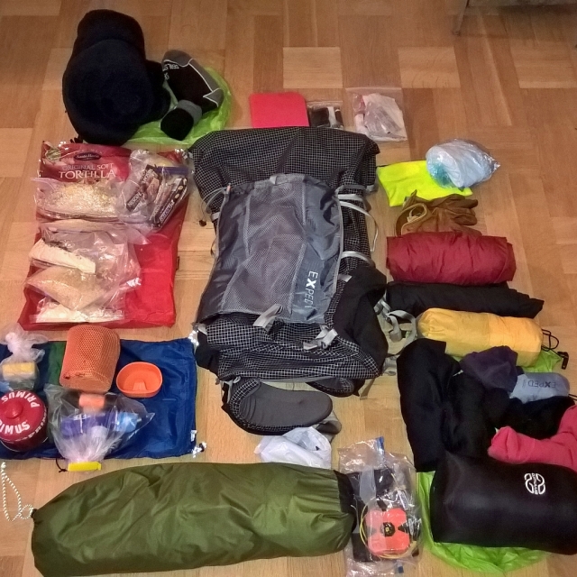
When it comes to gear I think I’m pretty close to a perfect pack. I can’t say enough good things about my backpack. I really like it more and more. The thing I’ll change will probably be the tent. I want to get a sub 1kg tent, and as said in earlier posts I’m looking at the Locus Gear Hapi, with a solid inner. The Tarptent Notch is also on my list, witch is cheaper, lighter and with a smaller footprint. We’ll see what I’ll end up with.
Next hike will probably be in Tiveden Nationalpark.

Hi there. Are you still here? I’m planning a trip to Tresticklan with my girlfriend in early September. I’ve found your post incredibly helpful as there’s not much information around the web from what I’ve been able to find. I’ve been looking at the map and I assume the 5K loop you are speaking of is the one that begins almost right when you enter the NP from Råbocken, right? We would really like to go to Budalsvika and then down by the shoreline to find a suitable camping spot on the banks of Boksjön. Is that possible you think? Or is is it impossible/impractical to follow the shoreline. Thank you very much.
LikeLike
The shores are pretty steep near Boksjön, from what I could see. There is a spot about 500-1000 meters south of Budalsvika, if you follow the trail/road and then turn left. It’s a flat surface, and there are traces of old campfires there. This was the spot I had as a second choice if I hadn’t found the spot I did up on the ridge. I don’t know how it looks on the Swedish side though. It’s possible that it is flatter over on that side, and easier to camp near the lake.
LikeLike
Hi again, thanks for getting back to me. I assume you mean you don’t know how things look on the Norwegian side, right? How was the mobile reception in the area, do you know? Did you navigate with GPS or compass/topographic map or was a simple map enough? Did you see a lot of trails outside of the big red one drawn on the map – the one that leads to Budalsvika and the loop. Thank you so much for the information.
LikeLike
The campspot I’m refering to is on the Norwegian side, if you follow the trail after you’ve passed Budalsvika. There might be a spot on the Swedish side of the border if you walk down towards the lake just before you reach the little bridge that marks the border. From what I can remeber cellphone-reception wasn’t so great neither in Tresticklan nor Lundsneset.
I didn’t use a GPS but instead used maps from https://kso.etjanster.lantmateriet.se/ for Tresticklan and http://www.ut.no/sted/5.35410/ for Lundsneset. Apart from the loop-trail and the trail from Råbocken to Budalsvika there is a trail in the north-south direction. It connects in the south to the looptrail and in north to the east-west trail before the Norwegian border. These trails are marked on Lantmäteriets maps though. I did find one trail that wasn’t marked on the map, and that was the trail that led south on Skacklenäset. Other than that I didn’t see any trails except the marked ones.
LikeLike
Got it. Thank you very much for your help!
LikeLike
Pingback: The hiking year 2016 – Småland Outdoor
Pingback: Preliminary planning for 2017 – Småland Outdoor
Pingback: Tresticklan – first trip of 2018 – Småland Outdoor