Geocaching day trip on Rottnen

Vacation is here, and on a regular year we would be traveling to Athens to visit my wife’s relatives. But with the Corona situation and travel bans this year, we’re “stuck” in Sweden. Växjö is known for its lack of sun, and constant rain. From October last year to February this year the sun only came out a handful of times. Despite this the weather has been great so far this spring and summer, so staying in Sweden isn’t a problem.

Last Wednesday my wife and I decided to bring C to do a Geocaching day trip on the lake Rottnen, some 20km east of Växjö.

We started at the beach called Sandstaden, that’s a relatively popular beach, despite being out in the middle of nowhere. When we arrived there where already several families on the beach.

I unloaded the canoe from the roof of my car, while C and Mia carried our gear down to the water. We paddled straight out from the beach to a set of islands 600 meters out. There we found our first geocache, and after that we paddled around the rest of the islands to check them out for possible campsites for future trips. The islands where too rocky for a tent though, but we took a short snack break on one of the islands, that was scarred from what seemed to be a recent fire.

After the break we kept paddling north for a few kilometers, before we decided to get to shore on an island to have lunch. Mia and C cooled off in the lake while I fried Krabbelurer on the Trangia. I ended up making more than we could eat, and after dinner Mia rolled out the sleeping mat and fell asleep for a short while. Me and C hung out in the hammock, and I hoped she would fall asleep too. In vain though, as aha was too pumped up to sleep, and just wanted to play.

After lunch we kept paddling north, and found our second geocache in the ruins of an old hut.

We paddled a short distance to the next cache, but couldn’t find it. But we had stopped in a shallow sandy cove, and despite being more than 30 meters out, the water was only up to our knees.

We spent a while cooling off there, and C played hide and seek behind the canoe.

The last cache for the day was a bit further to the north, on a stretch of stepping stones, laid out in the water in the old days, to make it possible for travelers to cross between to capes. The last bit was very shallow, and covered in reed, and eventually I had to stand up in the canoe and stake our way forward.

We found the cache, and paddled back towards Sandstaden. It was starting to get late, and C wanted to play at Sandstaden before we headed back home. When we came near Sandstaden we hit a rock, and I felt the canoe bulge as we passed over it. Fortunately the canoe is durable. When we came back to Sandstaden we put our gear in the car, and took a quick dip before heading home.

Rottnen was a great lake for paddling, but scarcer when in came to possible camp sites for tents. I want to go back though, and explore more.

Day trip with the canoe

Spring (summer?) came quickly here in southern Sweden. While the temperatures still drop below freezing on occasional nights, the day time temperature rise to above 20° C. I’ve been waiting for a chance to take the canoe out for a paddle, and last  weekend I put it in the water for the first time of 2019.

All of the family, except my oldest daughter, joined me, and we drove to Tolgasjön. Near the peninsula where I’ve been camping with C the last few times, there’s a perfect parking spot, wide enough for a few cars. We parked there, walked out to the far end of the peninsula to make some coffee before we put the canoe in the water.

The farmers had been fertilizing their fields, so every time there was a breeze, the air was filled with the sour smell of what I think was pigs manure. Other than that, it was perfect.

The weather was warm and sunny, and most of the times we only had a slight breeze. Perfect paddling weather.

We paddled to an island in the lake, where C and I had camped in November last year. It was almost dinner time, but when we walked up to the nice sunny area where we planned to lay out the cellfoam mats and make dinner, a Canada goose started yelling. It stood up, trying to look big, and shrieked endlessly. Another goose flew in too. We saw that it had a nest with eggs in it, so we decided to move away, and make dinner further away from in. It calmed down, but kept looking at us.

The rest of the afternoon we did as little as possible. The kids played by themselves most of the times, and enjoyed the simple pleasures of throwing sticks and stones in the water. Maria, my wife, rolled out the sleeping mat on a cliff an dozed off in the sun, while I hung up the hammock between two trees next to the kids and relaxed in the sun.

We had a really relaxing time. Apart from the occasional airplane passing above us, we didn’t here much man-made sounds. The wind blew through the trees, but when it died down it was absolutely quite. When you live in the city, where there’s constant sounds of traffic, dogs, sirens, music and people, getting out in nature and get this sort of tranquility is really remedy for the soul.

Eventually it was time to pack up though. I would have loved to stay overnight, but this was only a day trip.

We made coffee one last time, before we put on our life vests and packed the canoe again. We slowly paddled back towards the car, on the calm beautiful lake.

It was a nice day trip, and I’m really glad I bought a canoe. It makes it so much easier to find secluded beautiful spots near home. Småland is littered with lakes, filled with small islands like this, perfect for short getaways.

We’ll see when I’ll get out on a canoe camping trip again. But I’d really like to get out on a trip again soon.

Day hike at Stora Mosse National park

A few weeks ago I took C with me to Stora Mosse National Park, about an hours drive north of Växjö. I’ve been here before, and last March I camped here.

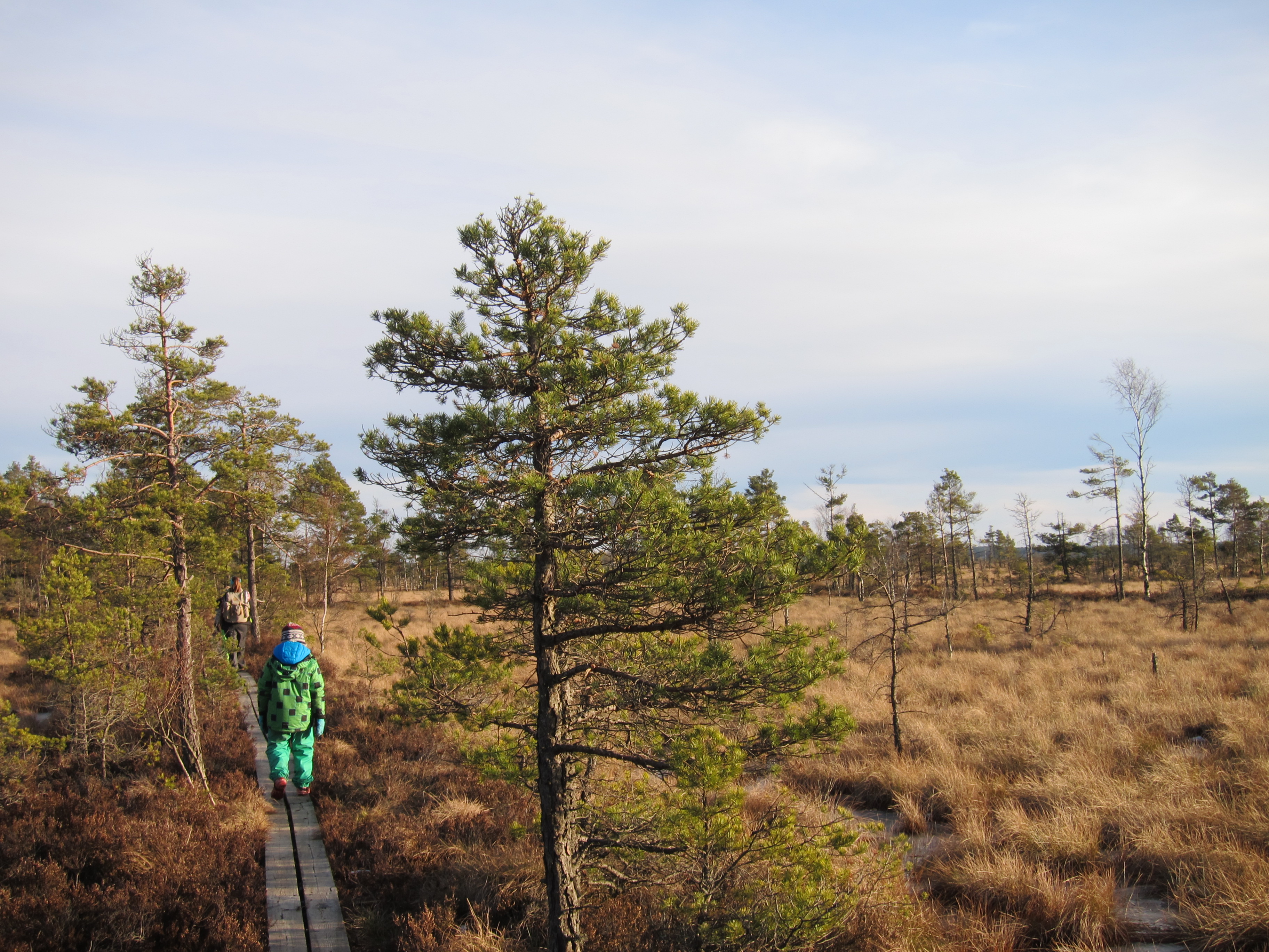
Stora Mosse is a large mire, the largest in southern Sweden, with dozens of km of footbridges across it. Spread out in the “mire-ocean” are several islands. Camping has been prohibited before, but since a couple of years back you’re able to camp on a few designated places in the park.

The mire consists of a southern and northern part, cut in the middle by a road and a railroad. The previous times I’ve started at the northern end of the south section. But this time I wanted to see the northern section.

I parked the car at the main entrance and we started to walk the trail around the lake there. We hiked for just a short while, until we stopped to make some coffee and hot coco.

While we stopped I changed my mind, and decided that I wanted to go to the southern parts anyways, where there are more vast views. This time though, I would start at the southern tip of the mire instead.

We drove to one of the southernmost entrances instead, and started to hike.

After only a short while, we stopped at a bridge with benches to make lunch.

The first part of the trail stretched through a pine forest, but after a while the trail turned and became footbridges that stretched some 6km north across the mire.

C hiked on in a good pace, and even though she missed a couple of steps and put her foot down in the wet mire she was in good spirits.

When we came to an intersection we turned west towards the “mainland”. We where going to hike a circle trail with an observation tower on a hill in the forest.

Once back in the forest the trail went uphill. C preferred to ride on my shoulders in the uphills.

On top of the hill there was a large observation tower, made for bird watching. We climbed the steep stairs to the top, and enjoyed the view. I’m a bit scared of heights. But when I told C that, and said that I wanted to go back down she replied that it was NOT scary. It was JUST exciting to be up there. So we stayed there for a while longer.

When we got back down we hiked the rest of the loop to get back to the car. We had been out the entire day, but C still didn’t want to get back home. She was disappointed that we’d only gone on a day hike, and wanted us to camp there. I promised her that we’d camp the next time we got there.

Family daytrip with the canoe

This year the spring has been better than in a long time. I don’t think I even remember such  warm sunny spring as this.

Almost the entire May the weather has been sunny, with temperatures around 25-30°C. It has only rained on a couple of occasions last month, despite us living in one of the rainiest cities in the country.

Me and my wife decided to go on a canoe trip on the nearby lake Helgasjön. We wanted to be close to water, but do something more than just to lay on the beach. We even got our thirteen year old to join us, which we where happy about.

We drove to Helgö/Jägaregap, where I’ve parked before on the canoe trips I made in September and October last year. When we arrived another family just left the beach in their canoe.

I got the canoe off the roof of the car, we packed it with our food and then left Helgö. My wife sat in the front, I sat in the back and our daughters sat in the middle.

20180603_092511039_iOS.jpg

It was quite windy,  and the waves rocked the canoe a bit. The lake was also filled with motorboats, sailboats and jetskis that created even larger waves as they passed us.

Our destination was Ramsö, where I had camped in October. I knew that there was a small beach in a cove, and we hoped that it wouldn’t be occupied.

As we closed in, we saw a boat slow down, and then leave after a couple of minutes. When we where close enough to see the beach we saw that three girls where already at the beach. We decided to paddle around the island and search for another beach, but we circled the entire island with no luck. Eventually we decided to invade the beach anyways.

20180603_104024987_iOS.jpg

We landed the canoe on one side of the beach and put out our picnic blanket and our food. We started to chat with the girls, and they told us that they had been dropped off earlier, and the guys in the boat where fishing somewhere north of the island.

We had a lunch of baguettes, cream cheeses and cherry tomatoes. Kind of our standard picnic food when we’re too lazy to make real food to bring.

20180603_104611670_iOS.jpg

After a while the boat came back with three guys, and they tied the boat to a tree nearby.

The water was pretty cold, so we didn’t swim, but we did bathe our feet and legs a bit. C was the only one brave enough to dip.

We stayed there for a little more than an hour, and then decided to paddle back, as we had some chores to do. On the way back the soothing waves rocked C to sleep, and she slept in her big sisters arms.

20180603_114332441_iOS.jpg

It was a short but nice trip. The weather is great for canoeing, and I’m glad that both my wife and my oldest daughter joined me.

Day-hike on Söderåsen i April

General info

Söderåsen national park is a 1625 acre national park close to Ljungbyhed in Skåne. The area has deep rift valleys and beautiful deciduous forests. There are lots of trails in the park, and SL3, section 4 and section 5 of the 1000 km long Skåneleden goes through the park.

In the park you’re not allowed to camp other than on the designated campsites at Liagården and Dahlbergs, where there are huts with beds, free of charge. There are also toilets and fireplaces scattered throughout the park.

Trip report

Last weekend I drove to Söderåsen with my wife and daughters. Our first plan was to do a car camping trip, where we would hike in a circle and then set up camp near the car. The forecast predicted lows around freezing, and my wife didn’t want to have the first tent night with our youngest in those temperatures, so we ended up doing a day-hike instead of an overnighter.

The weather report had switched back and forth between sunny and rainy the entire week, but when we drove the two hours from home to the national park, the skies where covered in clouds. When we had only 15 minutes left it started to rain, and by the time we got to the parking lot it was pouring down. We thought about keep on driving to Kullaberg nature reserve instead, but after a short while, the rain subsided.


We put on our packs and started hiking. The skies cleared up fast, and by the time we had climbed the first hill, the sun was shining. We had lunch on the ridge and tried three different flavors of Knorr Spaghetteria. On their new ones you only have to add boiling water, as opposed to the old ones where you had to boil them for 7 minutes. For a price of 15 SEK /$1,5 they were a lot cheaper than your regular freeze-dried meal. You need two of them though, as the portions are rather small but it’s still a lot cheaper.


Despite being relatively close to home, I’ve never been in Söderåsen national park. There was quite a lot of elevation, and the highest peak in Skåne is here, at the modest height of 212 meters. It doesn’t sound like much, but in a relatively flat landscape it feels higher.


We followed the ridge along the edge all the way until we dropped down between two ridges. Our trail connected to Skåneleden and we passed a bridge over a creek that runs through the park.


We did some Geocaching, but didn’t pass that many on our hike. We followed the creek for a while before we crossed the creek again and hiked up on another ridge and passed Liagården shelter area. It was only April, but there where tents scattered over the entire area. The fireplaces were burning, and the lean-to shelter filled with gear. In peak season it could be hard to find room for your tent.

We didn’t stop at Liagården, but continued on the ridge back to towards the car. We where all starting to get tired, and hiked back to the parking lot without many breaks.

Söderåsen was a beautiful place, but its proximity to the Malmö/Copenhagen-area makes it an well visited area, and even in April it felt crowded at times. I will get back here though, as I’d like to see the area in autumn colors. But I’ll probably try to find a campsite outside of the parks, where you could get more privacy.

The trip also served as a test run of my wifes 3F Ul Gear backpack that we bought from Aliexpress. It worked good, but using a frameless pack do require more care when packing. But it should be good for weekend trips.

Pico do Arieiro to Pico Ruivo on Madeira

General info

The week before Easter the whole family on my wifes side went on vacation to Madeira. Madeira is a small island located in the Atlantic ocean, off the west coast of north Africa. It’s an autonomous region of Portugal. The island is relatively small, but it’s full of mountains, and the capital Funchal is built on the mountainside. The highest point of the island is Pico Ruivo, at 1862 meters above sea level. Madeira is a mecka for day hikers, as the island has a system of more than 2,170 km of levadas, accompanied with a walking trails. Levadas are aqueducts made to carry water to the agricultural regions.

Trip report

The trail between Pico do Arieiro and Pico Ruivo offers some stunning views, as you hike on the top of the island. The round-trip is about 12 km. On Pico do Arieiro theres a big parking lot, and the road to Pico do Arieiro is in good shape.

As me and my wife drove from the house we rented in Funchal, we left the 20°C and palm trees for colder weather. As we came higher up the mountain we first drove through Eucalyptus forests. Even higher than that the Eucalyptus trees got replaced with a really old-looking spruce forest. It didn’t feel like we were close to the equator, but we could just as well have been in an old forest in the Nordic. The spruce forest was a lot more beautiful than I’m used to though, since most of the spruce forests in the south of Sweden consists of dense plantations.

Even higher than that bushes and grass replaced the spruces. We saw a man and his teenage son hitchhiking and picked them up. They were on their way to Pico do Arieiro and was going to hike the same trail as we did.

When we came to the parking lot it was full. We dropped our passengers off and drove down the road and parked at the side of it.

The skies were partly clouded, and the air was cool. I was glad that I had brought my synthetic puffy.

IMG_8834IMG_8838

The wind blew hard, and the trail was narrow at places, with steep sides. My wife has a fear of heights, and that fear was even bigger than she knew before this hike. But she overcame it and hiked the entire trail, despite the the height.

Almost the entire hike we had clouds around us, or just above our heads. On most parts of the trail there was wires as a fence from the cliffs. But in several places the poles had come lose, and the wires hung outside of the cliffs.

After a few km there is an intersection. The right trail is supposed to be a harder trail than the left one. But it was closed, so we took the left one instead, which goes through a series of tunnels.

IMG_8843IMG_8854IMG_8858

When we came near Pico Ruivo we passed a dead forest. The trees, with branches that had been twisted by wind, had died from a fire. The boles where pale and white, with the cracks painted black by soot.

IMG_8871

Just under the top of Pico Ruivo there is a cabin. We were hungry, and hoped it would be a cabin that sold food, but unfortunately it was closed. We rested for a while and ate the snacks we’d brought and then hiked the last 500 meters up to the top of Pico Ruivo. The top was covered in clouds so we didn’t get any spectacular views.

We found a geocach on the top, and after we logged it we turned back towards Pico Arieiro. As we hiked back we saw two pigeon-sized birds next to the trail. They were probably quite used to humans as they sat still while we photographed them.

IMG_8887

On the last stretch back to the car the trail was covered in fog, and the wind blew hard. We had brought too little food and were both very hungry. The fog made the parts on the image below feel almost magic. It felt like the trail was floating in the clouds.

IMG_8890

When we came back to the parking lot we stopped by the restaurant there and bought my new favorite fast food. A Portuguese steak sandwich. Two slices of Portuguese bread with garlic butter, a steak and a fried egg (plus cheese and ham, if you like the special). It was both cheap and delicious, and well needed after the hike.

Tomorrow evening I’ll be back on the trail, as I’ll hike Sigfridsleden from Asa to Växjö. It’ll be great to get a couple of nights under the stars again.

Day hike at Stora Mosse in March

General info

Stora Mosse National park is located just north west of Värnamo, about an hours drive from Växjö and was formed in 1982. Almost the entire park consists of mire, and it’s the largest untouched mire in Sweden, south of Lappland. Together with Brokullen och Långö Mosse it’s almost 8000 acres of protected land. There is a system of pine forest “islands” within the mire, and there are 40 km of hiking trails in the park. Some of them are possible to use with wheelchairs or a baby stroller, while other trails cross the mire on 30cm wide foot-bridges. If you want to leave the foot-bridges it’s possible to use snow-shoes to hike in the mire.

From 2013 it’s also allowed to camp in certain areas in the park. Detailed maps can be found here. If you’re lucky you might spot one of the White-tailed eagles or Golden eagles living in the area.

You get here by road 151 between Värnamo and Gnosjö, and the road cuts right through the park. In the middle of the park there is a visitors center, but be sure to check the opening hours before you get there.

Trip report

Last weekend, on March 12, me and the family drove to Stora Mosse National park for a day hike. We had planned and packed most of the stuff we needed the day before. We decided not to bring a stove, but instead bring sandwiches, snacks and vacuum bottles with warm water and hot coco.

It was an hours drive from home, and we got to the park at around 11.00. We followed road 151 and drove to the main entrance, near the visitors center. We didn’t go the the visitors center though, but started hiking at once. First, we had planned to hike around Kävsjö, but that’s 13 km and that would be a too long hike for my son to do. So instead we decided to hike the Lilla Lövö runt, a circle trail that’s 6,4 km long, south of road 151.

IMG_8665
My son and oldest daughter . Lilla Lövö is the island to the right

It’s a two km long road walk from the visitors center, but you could drive up to the trail head, where there’s a parking lot and toilets. There is a bridge over the railways that cuts through the park, and on the bridge you get a good view over the vast mire.

My son and I took the car as my wife walked with my daughters from the visitors center. When we’d joined up we entered the trail. After the bridge there were a couple of hundred meters of solid ground before the foot-bridges begun.

The first section of the trail goes through parts of the mire that’s been used for to harvest peat and you can see traces of it with the square patterns in the mire.

After that you get out on untouched land. I wore high boots, and the rest of the family wore rubber boots. It was needed, as both of my older kids and my wife stepped in pools of water at the side of the foot-bridge.

IMG_8675
All across the mire there are small scattered trees

The foot-bridge stretched far om the horizon. After a while we came to a bench where we could have a rest and a snack. After a short rest we kept walking. We were closing in on Lilla Lövö. You’re allowed to camp on Lilla Lövö, but as far as I could see there wasn’t any place you could actually set up a tent. Most of the level ground was covered in storm fallen trees. I didn’t check the entire island though, and there might have been good campsites that I missed.

IMG_8684
My youngest daughter in the Osprey Poco Plus

IMG_8688
It was great to see the sun

We took a short break on a big rock, overlooking the east side of the mire. When we had packed up again we heard the sound of what we think were eagles. We didn’t see any though. After Lilla Lövö, which was mostly covered in spruce, we came into a beautiful pine forest. The sun had come out and made the forest even more beautiful. The last stretch of the hike was mainly through the pine forest, and we hiked in a faster pace than on the foot-bridges.

IMG_8699

Eventually we got back to the car. We’d been hiking for more than five hours, and the kids were tired. As we stood next to the car and packed up, we looked up and saw a flock of cranes passing us at a low altitude. There sound of their wings resembled that of a helicopter hovering. Just as they passed us we heard several splats. The cranes had pooped right as they passed us, and there was a diagonal line bird poo from the ground near the left back door, and over the roof and over to the right front door. We had been inches away from getting all of in on us. It felt like we just survived the blitz.

IMG_8711
The last section before we got back to the car

The day hike at Stora Mosse was great and we had nice weather. This early in the season you’re not bothered by mosquitoes, but I guess it’s worse in the summer with all the standing water. I’d like to spend a weekend hiking and camping here. But if I do I’ll probably try to find a campsite outside the park.

Short hike in Aegina/Greece

As I wrote in my last post me and the family have been on vacation for a few weeks, so there hasn’t been any hiking done. But in the last week my daughter and I decided to hike up to Mount Oros, the top of the island Aegina just outside of Athens. It’s about a 30 minute drive from the house and the last stretch is on a really bad road. You need a 4WD to get through. The road is not maintained and rainwater have flushed away gravel so you have to drive through pits and trenches. There were two cars in front of us, another Suzuki jeep and a Smartcar. The Smartcar stopped after a while though.

OLYMPUS DIGITAL CAMERA
Our ride to the trailhead. The fantastic Suzuki Grand Vitara

OLYMPUS DIGITAL CAMERA
View from the trailhead.

We drove up to the trailhead. In the other car there were four people and a dog. They had camping gear and had planned to sleep on the top of Oros. They stayed at their car, as me and my daughter started to hike up. Despite being in the afternoon at 19.00 the temperature was around 30º C, but it was windy and felt like a pleasant temperature.

OLYMPUS DIGITAL CAMERA
My daughter at the trailhead

It was a rocky hike up to the top. We took a few breaks while going up, and looked down to see how it was going for the other guys. We saw the car leaving and then come back. As they started their way up we saw that they were now six people and two dogs. We figured that the Suzuki and the Smartcar had went together and that the Suzuki had went back to pick them up.

On the top of the mountain there is a small church built, There is a churchbell there, and as traditions bids, we rang it as we reached the top. The hike up didn’t take more than 40 minutes. We stayed up there for a half hour. Drinking water, eating tiropita (small cheese pies filled with feta) and enjoying the view. We started our decent again and met the other guys going up. After a while we heard the bell ringing as a sign that they had reached the top.

OLYMPUS DIGITAL CAMERA
A view from the top of Oros. The nearest island is Moni, were we previously have done some Urban Explorations in the ruins of old buildings and tunnels.

It was a short hike, but it was nice to get out and to get some nice views. I’d love to hike more and camp out in Greece one day.